


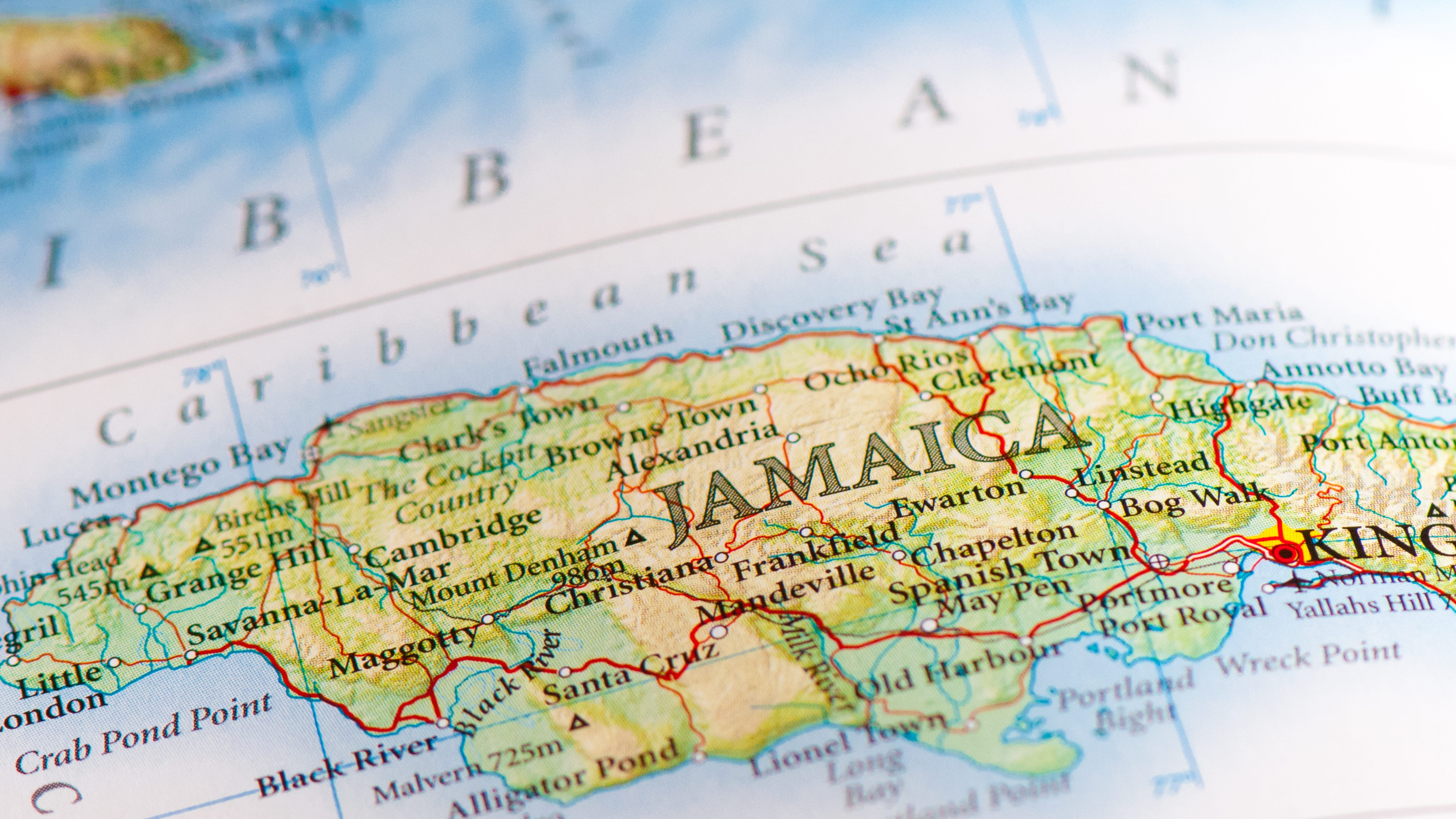
Jamaica Travel Guide for Drivers and Tourists: Move Through the Island With Confidence
January 30th 2026
Jamaica doesn't reveal itself all at once. It unfolds slowly—in the gap between towns, along coastal curves where the road hugs the sea, at a roadside stall where smoke curls from a pimento-wood fire. How you move through the island shapes what you discover.
This guide covers the full spectrum of Jamaican travel: when to visit, how to navigate the island's rhythms, and how a rental car—if it fits your trip—becomes a tool for deeper exploration.
We also address what most guides skip: realistic drive times with kids in the backseat, why certain roads challenge elderly travelers, where fuel stations actually exist (and where they don't), and how to move through Jamaica without friction.
When to Visit? Weather, Crowds, and Value
Jamaica's climate splits into two distinct seasons—not by temperature, but by rainfall.
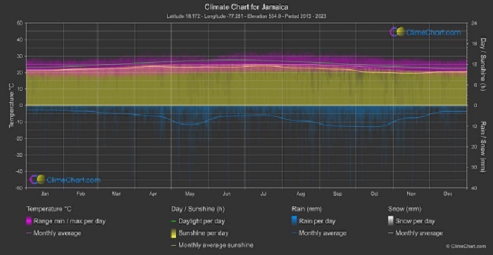
Dry season (December to April)
Most reliable weather with 75–85°F days, minimal rain, and steady trade winds. This is peak season. Expect higher prices (25–40% above the annual average) and crowded beaches near Montego Bay and Negril. Book accommodations 60+ days ahead. The trade-off: smooth roads (less pothole formation after rain) and ideal conditions for coastal drives.
Green season (May to November)
Brings brief afternoon showers—rarely all-day rain—and lush landscapes. Temperatures hover 82–90°F with higher humidity. This is Jamaica's value window: accommodations drop 30–50%, roads remain drivable outside storm events, and attractions feel spacious. Two caveats:
- Hurricane season peaks in August–October. Direct hits are rare (major storms average once every 5–7 years), but tropical waves can dump 4+ inches of rain in 12 hours—temporarily flooding low-lying roads near Black River and Negril. Check forecasts 48 hours pre-travel.
- South coast roads deteriorate faster during the green season. Unpaved sections near Treasure Beach become muddy washboards after heavy rain. Stick to north coast routes if visiting May–October with a standard sedan.
Shoulder months (late April, November)
Offer the sweet spot: dry-season weather softening into green-season pricing. November especially rewards travelers—rainfall drops sharply after mid-month, crowds thin, and resorts discount to fill rooms before the December rush.
Getting Around Jamaica: Four Options, When Each Makes Sense
How you move depends on your itinerary—not preference alone.
Resort Shuttles
work if you're staying 2–3 nights at an all-inclusive near Montego Bay or Negril with zero off-property plans. They're free but operate on fixed schedules (typically 9 a.m., 1 p.m., 4 p.m.). Miss the last shuttle? You're stranded until the next morning.
Taxis
Solve point-to-point transfers efficiently. From Sangster Airport to a Negril hotel: $45–60 flat rate. To Dunn's River Falls from Ocho Rios: $25–35 round-trip. But taxis create dependency. Drivers often double-book pickups. If you linger 20 minutes past your agreed-upon time at a waterfall, your ride may have left. Pre-book return transfers with reputable companies—not random drivers at attractions.
Route Taxis (shared minibuses)
cost $2–5 per ride and connect towns like Montego Bay, Falmouth, and Ocho Rios. They're authentic but impractical for tourists: no schedules (depart when full), limited luggage space, and infrequent service after 6 p.m. Only consider if traveling light for a single-day trip between adjacent towns.
Rental Cars
Choosing a rental car to explore Jamaica unlocks flexibility when your trip meets three thresholds:
- Staying 4+ nights
- Planning stops 30+ miles apart (e.g., Montego Bay to Port Antonio)
- Wanting control over timing (beach at sunrise, jerk lunch at a hidden spot)
Under these conditions, the car pays for itself by day three through avoided transfer fees and spontaneous discoveries. Over three days in one location? Taxis often make more sense.
Driving in Jamaica: Rules, Realities, and Adaptation
Jamaica drives on the left—a legacy of British rule. Your rental will have the steering wheel on the right side. This feels unfamiliar for 15–20 minutes, then recalibrates naturally. After airport pickup, drive to an empty parking lot (Rose Hall Great House works) and practice turns for 10 minutes. This small step reduces first-day stress significantly.
Key rules to know:
- Speed limits: 25–30 mph in towns, 50 mph on highways. Enforcement focuses on sobriety checkpoints—not speed traps.
- Roundabouts are common near Montego Bay and Ocho Rios. Yield to traffic already circulating inside the circle.
- Seat belts are mandatory for all passengers. Police rarely ticket tourists, but rental companies may charge cleaning fees if sensors detect unbuckled seats.
- Zero-tolerance alcohol policy: 0.08% blood alcohol limit. One Red Stripe won't register—but two might after a hot day. When in doubt, skip driving after drinking.
Road conditions vary by region:
- North Coast Highway (Montego Bay to Ocho Rios): Well-paved, frequent signage, gentle curves. Suitable for all vehicle types.
- South Coast (Kingston to Treasure Beach): Potholes increase south of Mandeville. Unpaved sections appear beyond Alligator Pond. Requires an SUV with higher ground clearance.
- Blue Mountains access roads: Steep grades (up to 18%), 67 switchbacks in 22 miles, zero guardrails on cliff sections. SUV mandatory. Daylight driving only—fog eliminates visibility after 4 p.m.
Night driving reality: Street lighting vanishes outside major towns. Unmarked speed bumps ("sleeping policemen"), wandering livestock, and pedestrians in dark clothing multiply risks. 78% of tourist-involved incidents occur after 6 p.m. (Jamaica Constabulary Force 2025 data). Recommendation: Reach your accommodation before sunset for your first three days. Build road confidence before attempting night drives—and limit them to the North Coast Highway, even then.
What You Need to Drive and Rental? Documents, Insurance, and Payment
Documents
- A driver's license from your home country works if printed in English (U.S., Canada, UK, EU, Australia). No International Driving Permit required.
- If your license is in German, Japanese, Arabic, or non-Latin script, you must carry an International Driving Permit alongside it. Order through your automobile association 3 weeks pre-trip.
- Your passport must match your license name exactly. Discrepancies cause rental delays.
- Minimum age: 25 years old. Drivers 21–24 pay $22/day, with young driver fees due to higher insurance risk.
Insurance
Basic third-party liability (covers damage to others) is included. Collision Damage Waiver (CDW)—protection for the rental car itself—is optional but strongly recommended.
Why? Pothole strikes and animal collisions represent 73% of tourist claims in Jamaica. Most U.S./Canadian credit cards exclude these "single-vehicle incidents" from coverage. Before declining CDW, call your card issuer and ask: "Does my rental insurance cover pothole damage and animal strikes in Jamaica?" If they hesitate, buy the CDW. That $18–22/day fee prevents $1,500+ out-of-pocket repair bills.
Credit cards
A Visa or Mastercard in the driver's name is required for the security deposit hold ($750–$1,200). Debit cards fail 94% of the time—banks process rental holds differently, often declining them outright. Bring a credit card with available credit exceeding $1,500 to avoid pickup delays.
Choosing the Right Vehicle to Drive Around Jamaica
Compact SUVs (Toyota RAV4, Honda CR-V class) suit 90% of travelers. Why?
- 8+ inches of ground clearance handles potholes and unpaved resort driveways
- Spacious enough for 4 adults with luggage
- Automatic transmission standard (no need to request)
- Fuel economy remains reasonable (~26 MPG highway)
Economy sedans work only on the North Coast Highway and in towns. Avoid them for south coast routes or mountain drives—undercarriage damage claims run 4.7x higher for low-clearance vehicles on rough roads.
Full-size SUVs make sense for groups of 5+, travelers with surfboards/scuba gear, or those prioritizing cabin space over fuel economy. Expect 18–22 MPG—budget $20–25 extra daily for fuel versus compact SUVs.
Avoid convertibles despite their island appeal. Luggage space is tight, and sudden afternoon showers appear without warning—leaving you scrambling to raise the top on winding roads.
Three Ideal Routes Explore by Driving in Jamaica
The North Coast Loop: Montego Bay → Negril → Ocho Rios
This 180-mile route along Jamaica's tourist-friendly north shore works for families, first-timers, and multi-generational groups. Roads are paved, fuel stops are frequent, and attractions are spaced for comfortable day trips.
Start in Montego Bay after airport pickup. The 48-mile drive west to Negril takes 105 minutes—not the 75 minutes GPS suggests—due to narrow lanes and spontaneous stops. Fill your tank at the Shell station on Gloucester Avenue before leaving Montego Bay; your next reliable stop appears just east of Lucea.
Stop Saturday mornings at Lucea's farmer's market (8 a.m.–1 p.m.) for fresh mangoes and coconut water. Arrive in Negril by 2 p.m. to secure beachfront parking at Seven Mile Beach before crowds peak. Sunset at Rick's Café requires arrival by 4:30 p.m.—the cliffside perch fills fast.
Spend two nights in Negril. Mornings belong to Seven Mile Beach's calm eastern end near the lighthouse—ideal for kids. Afternoons, drive 15 minutes to the West End for cliff views (strong swimmers only for jumping). Skip the cliff road if traveling with vertigo-prone elders—stick to Norman Manley Boulevard's flat coastal stretch.
The 75-mile drive east to Ocho Rios demands 150 minutes minimum. Break the journey in Falmouth at Water Square—a shaded plaza with ice cream vendors and gentle sea access where children can splash while adults rest. Critical timing: avoid driving between 11 a.m. and 2 p.m. Peak heat transforms cars into ovens. Leave Negril by 9 a.m. or after 3 p.m. Top up fuel two miles west of Ocho Rios before continuing.
In Ocho Rios, visit Dunn's River Falls early (opens 8:30 a.m.) to beat cruise ship crowds. The 60-mile return drive to Montego Bay takes 120 minutes—smooth sailing on the North Coast Highway.
With Kids: Pack ginger chews for the Falmouth curves. Motion sickness hits hard on winding stretches. Avoid midday driving—cabin temps exceed 105°F. Book ground-floor hotel rooms; 68% of Negril properties lack elevators.
With Elderly People: Prioritize flat coastal routes over cliff roads. Confirm accommodations have step-free entry and ground-floor options before booking.
With pets: Never leave animals unattended in parked cars—even with windows cracked. Jamaican sun pushes interiors past 140°F in fifteen minutes. Bloody Bay Beach allows dogs before 9 a.m. only. Confirm car rental pet policies and hotal policy, pre-booking—most cap dogs at 25 pounds with $50 nightly fees.
The South Coast Journey: Kingston → Treasure Beach
This 93-mile route reveals raw, unpolished Jamaica—fishing villages unchanged for decades, empty beaches, rhythms dictated by tide and catch. But it demands respect.
Depart Kingston after 9 a.m. to avoid downtown congestion. The 55-mile climb to Mandeville consumes two hours due to potholes and slow-moving trucks. Fill your tank at Mandeville's Shell station on Croydon Road—your last reliable premium fuel stop.
South of Alligator Pond, pavement gives way to gravel washboards. Reduce speed to 25 mph. The 38-mile descent to Treasure Beach takes 110 minutes despite the short distance.
Treasure Beach isn't a resort town—it's three quiet coves strung along a fishing village. Stay at a guesthouse for authentic charm—but note uneven pathways challenge mobility-limited travelers. Eat at local spots like Jack Sprat for fresh-caught snapper grilled over pimento wood.
Critical constraints:
- SUV mandatory—sedans scrape undercarriages on unpaved sections
- Top up fuel in Mandeville, even at ½ tank—Treasure Beach's single station often runs dry
- No cell service for 16 miles south of Mandeville—download offline maps pre-departure
Skip this route with children under 8 (bumpy roads cause motion sickness) or elderly travelers with spinal/joint conditions (road vibration exceeds comfort thresholds).
Blue Mountains Escape: Kingston → Newcastle
When coastal humidity becomes oppressive, the Blue Mountains offer relief—temperatures drop 15–20°F above 3,000 feet. This 22-mile ascent from Kingston to Newcastle consumes 80 minutes due to 67 switchbacks carved into steep grades.
Non-negotiables:
- SUVs only—sedans scrape undercarriages within minutes
- Daylight driving exclusively—fog eliminates visibility after 4 p.m.
- Full tank before departure—no stations exist above 2,000 feet
- Offline maps downloaded pre-ascent—cell service vanishes above 3,000 feet
Visit a working coffee estate like Lime Tree Farm for tours and misty valley views. The cool air and panoramic vistas deliver a Jamaica most tourists never experience.
With kids: Switchbacks cause motion sickness. Give ginger chews pre-ascent. Promise a hot chocolate reward at Newcastle's coffee shop.
With elderly Travelers: Altitude above 4,000 feet may cause mild shortness of breath. Stop in Newcastle (3,500 ft) for 30 minutes to acclimate. Avoid entirely with cardiac or respiratory conditions.
Where to Stay? Regions, Parking, and Practical Notes
Montego Bay suits short stays and airport convenience. Most hotels offer free, secure parking. Avoid downtown lodging if renting a car—narrow streets and aggressive traffic create stress after a long flight. Stick to Rose Hall or Gloucester Avenue areas for easier navigation.
Negril divides into two zones: Seven Mile Beach (resort strip with flat roads, ample parking) and West End (cliffside, narrow lanes, limited parking). Families and elderly travelers should prioritize Seven Mile Beach properties with ground-floor rooms. West End suits adventurous couples comfortable with tight turns and steep driveways.
Ocho Rios clusters around the cruise port. Stay west of town (Turtle Bay area) for quieter streets and easier highway access. Downtown Ocho Rios has congested traffic—avoid if possible with a rental car.
Treasure Beach offers authenticity but limited infrastructure. Most guesthouses have dirt or gravel driveways—high-clearance vehicles handle these better. Parking is rarely an issue (low traffic), but confirm property access before booking if mobility is a concern.
Port Antonio (east coast) rewards travelers seeking quiet. Roads from Ocho Rios are winding but paved. Stay near the harbor for flat terrain and easy parking. Avoid hillside properties if traveling with elderly passengers—steep, uneven paths challenge mobility.
Hidden Realities Most Travelers Miss
Fuel gaps matter: Between Ocho Rios and Oracabessa, 38 miles separate reliable gas stations. The single rural pump midway often sells low-grade fuel that clogs injectors. Top up in Ocho Rios even at ½ tank. The same rule applies south of Mandeville toward Treasure Beach.
"Sleeping policemen" hide around curves: Jamaican slang for unmarked speed bumps. They appear suddenly in villages—often without warning signs. Cruise at 25–30 mph through small towns, especially at dusk when shadows hide them.
Livestock wanders freely: Goats, chickens, and the occasional cow treat roads as personal pathways—especially in rural parishes like St. Elizabeth and Manchester. Slow down at dusk when animals move most.
Parking attendants are unofficial but helpful: At Seven Mile Beach and popular waterfalls, informal attendants watch vehicles. Tip $1–2 USD—they prevent scratches and deter opportunistic theft. Ignoring them risks minor damage; hostility is rare but possible.
Rain changes everything: After heavy showers, potholes fill with water and become invisible craters. Reduce speed by 15–20% until roads dry. South coast unpaved sections turn to mud—avoid entirely for 12–24 hours post-storm.
Final Tips
- Book rentals 3+ weeks ahead during December–April. Airport locations sell out early; walk-up rates cost 30–50% more.
- Take photos with the agent before driving off. Video any existing scratches or dents together—saves disputes later.
- Carry small bills—for parking attendants, rural fuel stops preferring cash, and roadside vendors.
- Download offline maps before landing—Google Maps loses signal in the mountains and rural south coast.
- Embrace "soon come" time—Jamaican roads reward patience. Rushing creates tension. Put on Bob Marley, roll the windows down, and let the island set the pace.
Frequently Asked Questions
Is it safe to drive in Jamaica as a tourist?
Driving in Jamaica is possible but challenging for foreigners due to aggressive local drivers, narrow winding roads, potholes, and poor lighting. Coastal highways are better, but inland routes can be risky. Avoid night driving, especially in rural areas. Stick to tourist zones like Montego Bay, Negril, and Ocho Rios for safer conditions.
What side of the road do people drive on in Jamaica?
Jamaica drives on the left side of the road, following British colonial rules. This surprises many North American and European tourists. Rental cars have right-hand steering. Practice in a parking lot first. Use mirrors frequently and allow extra space, as overtaking is common and aggressive on highways.
How reliable are fuel stations in Jamaica, especially in rural areas?
Fuel stations are plentiful in cities like Kingston, Montego Bay, and along main highways, but sparse in rural or inland regions. Fill up in tourist areas or before long drives. Gas is sold by the liter, and prices fluctuate. Carry cash, as some remote stations may not accept cards.
Is it fine to drive with kids in the backseat across Jamaica?
Plan short drives—Montego Bay to Negril takes 1.5-2 hours, not 45 minutes due to curves and traffic. Pack snacks, water, and entertainment. Use car seats for children under 3. Avoid mountain roads if kids get carsick. Coastal routes are smoother and more scenic for families.
Are Jamaican roads suitable for elderly travelers or those with mobility issues?
Coastal highways are manageable, but inland mountain roads are narrow, winding, steep, and potholed—challenging for elderly drivers. Poor lighting and aggressive traffic add stress. Consider hiring a private driver or sticking to flat resort areas. Always take breaks and avoid long drives in one day.
What speed limits should tourists follow in Jamaica?
Urban areas: 50 km/h (30 mph). Highways: 80 km/h (50 mph). Residential zones: 30 km/h. Limits are often unmarked—drive cautiously. Police enforce with radar. Speeding is common among locals, but tourists should obey to avoid fines or accidents on unpredictable roads.
Should tourists avoid driving at night in Jamaica?
Avoid night driving completely if possible. Roads lack lighting, potholes are invisible, pedestrians and animals appear suddenly, and crime risks increase. Rural areas are especially dangerous. If unavoidable, use well-lit tourist routes and stay alert. Most visitors plan daytime travel only.
How do I handle aggressive drivers and overtaking in Jamaica?
Local drivers overtake aggressively, even on curves—stay calm and defensive. Use your horn to signal presence. Keep right (since left-side driving) and allow space. Do not race or block—pull over if needed. Practice patience; mirroring their stle can lead to accidents for inexperienced tourists.
What documents must I carry while driving a rental car in Jamaica?
Carry your valid driver's license, rental agreement, vehicle registration, insurance papers, and fitness certificate (provided by the rental company). A passport copy helps. Seatbelts are mandatory for all. Children under 3 need infant carriers. Police checkpoints are common—have everything ready to avoid delays.
Is car insurance required, and what coverage should I get for Jamaica?
Third-party fire and theft insurance is mandatory and usually included in rentals. Add collision damage waiver (CDW) and personal accident coverage for protection. Roads are rough—pothole damage is common. Check rental terms; some credit cards offer extra coverage. Always inspect the car before driving off.
How long does it really take to drive between major spots like Montego Bay and Ocho Rios?
Montego Bay to Ocho Rios: 1.5-2 hours via the North Coast highway. Montego Bay to Negril: 1-1.5 hours. Kingston to Ocho Rios: 2-3 hours. Add time for traffic, stops, or winding sections. Google Maps underestimates—plan extra for kids, photos, or road conditions.
What should I do if I get pulled over by the police while driving in Jamaica?
Stay calm, pull over safely, keep your hands visible, and provide your license, rental papers, and registration. Police may check documents at checkpoints. Do not offer bribes—it's illegal. If unsure, ask for identification. Most stops are routine. Drive sober (low BAC limit) and obey rules to minimize issues.
What cultural etiquette should I know before visiting Jamaican communities?
Greet people with "Good morning" or "Respect"—Jamaicans value polite acknowledgment. Never photograph locals without permission, especially Rastafarian elders in Nine Mile or Port Antonio. Avoid wearing camouflage clothing—it's illegal for civilians under Jamaica's Defense Act.
When visiting rural areas, dress modestly: cover shoulders and knees at churches or family-run guesthouses. Accept offered food or drink when invited into homes—it's rude to refuse. "Soon come" isn't laziness; it reflects flexible time perception. Rushing locals creates tension—embrace the rhythm.
What's the best time of year to visit Jamaica if I plan to drive extensively?
December through April delivers optimal driving conditions: minimal rain preserves road surfaces (fewer potholes on the A1 highway), consistent sunshine aids navigation, and dry south coast routes remain passable even in sedans. However, this peak season brings 25–40% higher accommodation costs and crowded attractions near Dunn's River Falls.
For value-conscious drivers, November and late April offer the sweet spot—dry-season weather softening into green-season pricing with 30% lower rates.
Avoid August–October if driving south coast routes; hurricane season tropical waves dump 4+ inches of rain in 12 hours, turning unpaved sections near Alligator Pond into muddy washboards impassable for low-clearance vehicles.
North coast routes remain drivable year-round, but always check Jamaica Meteorological Service forecasts 48 hours pre-trip during the green season (May–November) to avoid temporary flooding near Negril's coastal roads after heavy showers.
Ready to unlock Jamaica on your own terms?
With Final Rentals in Jamaica, you can see the full price upfront, choose airport car rental pickup, and drive with 24/7 local support if you need help on the road. No hidden fees. No cancellation fees. No surprises. Just freedom to discover Jamaica your way.
About the Author
Final Rentals Editorial Team
The Final Rentals Editorial Team is a group of travel researchers and mobility experts dedicated to creating accurate, practical, and up-to-date travel content for drivers worldwide. Our articles are based on official tourism resources, local driving regulations, and destination research to help travellers plan safer and more enjoyable journeys. From car rental advice to road trip guides and local travel tips, we provide reliable information to help you explore with confidence.

