15 Things to Do in Grindelwald, Switzerland: What Is Worth It, What to Skip and What to Know
September 29th 2026
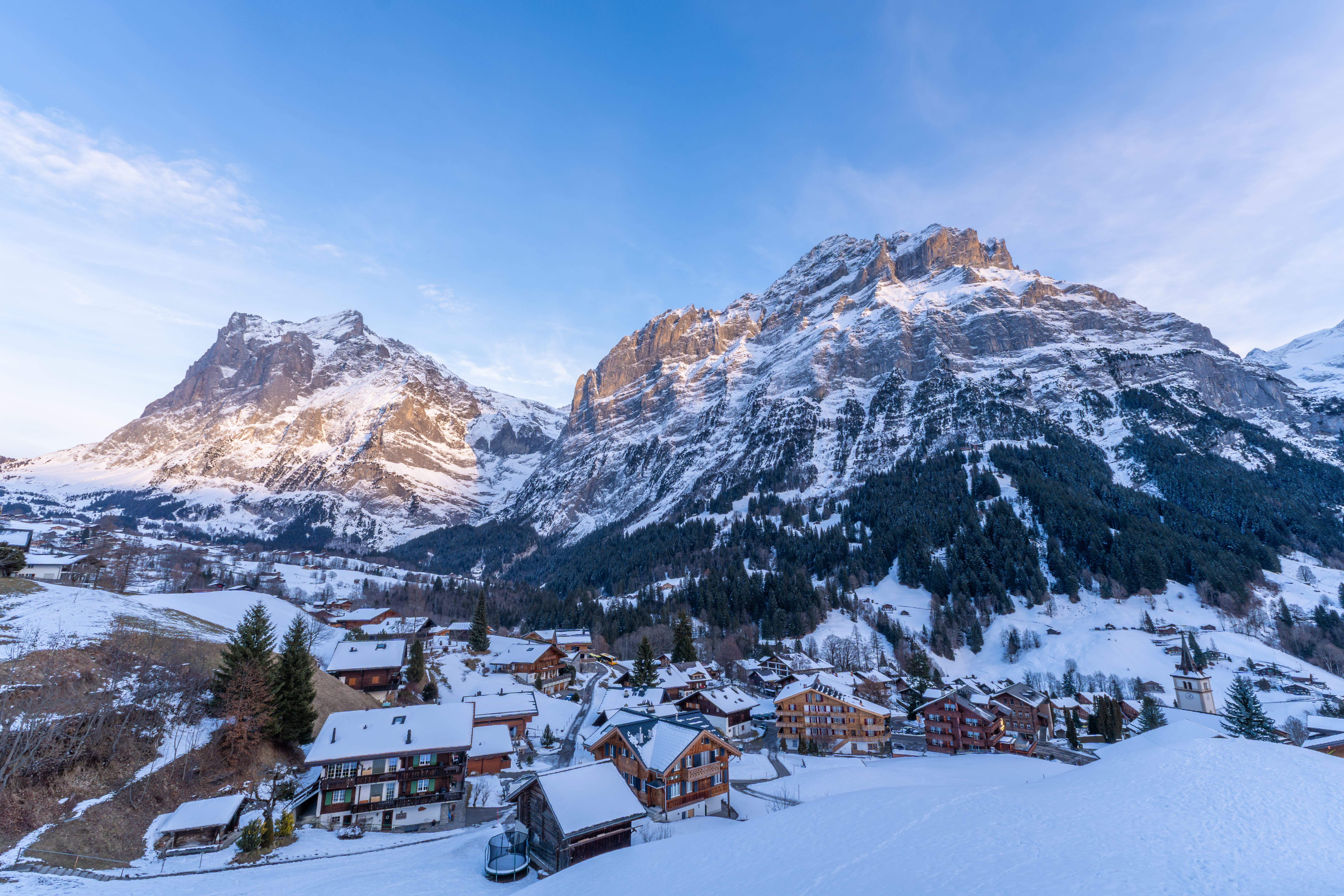
Grindelwald is one of those places that looks so unreal in photographs that you almost expect it to be a manufactured theme park. The north face of the Eiger looms directly over the village, cable cars stretch off into high alpine meadows in every direction, and the air smells like fresh pine and cold glacier runoff.
But planning a trip here comes with a sharp reality check.
Between expensive mountain passes, unpredictable alpine weather, and long queues for popular adventure activities, it is remarkably easy to spend a small fortune and end up rushing from one cable car to the next without actually taking the place in.
If you want to experience the best of Grindelwald without blowing your budget or burning yourself out, here is how to make smart decisions on the ground.
Grindelwald Quick Tradeoff Matrix

Image source: Pexels
Attraction | Cost | Effort | Time Needed | Weather Dependent? | Best For | Priority Level |
|---|---|---|---|---|---|---|
First & Cliff Walk | Medium | Low | Half Day | High | Panoramic Views & Walkways | High |
First Adventure Lifts | High | Low | Half Day | High | Thrill Seekers | Medium |
Bachalpsee Hike | Low | Medium | 2–3 Hours | High | Scenic Walkers & Nature | High |
Jungfraujoch | Very High | Low | Full Day | Extreme | First-Time Alpine Visitors | High (Clear Days Only) |
Glacier Canyon | Low | Low | 2 Hours | Low | Rainy Days & Cool Walks | High (Weather Backup) |
Canyon Swing | High | Low | 2 Hours | Medium | Pure Adrenaline | Low (Niche) |
Pfingstegg | Low | Low | 2–3 Hours | Medium | Relaxed Families | Medium |
Männlichen & Royal Walk | Medium | Low | Half Day | High | Eiger Views & Easy Walks | High |
Mürren Via Ferrata | Low | High | Half Day | High | Active Adventurers | Medium |
Lauterbrunnen Valley | Low | Low | Half Day | Low | Cascading Waterfalls | High |
Schilthorn | High | Low | Half Day | High | 360° Panoramas & Bond Fans | Medium |
Aare Gorge | Low | Low | Half Day | Low | Poor Weather Days | High (Weather Backup) |
Grindelwald First: Don't Just Go Up and Tick It Off

Image source: Pexels
It is very easy to look at First on a map, see a quick gondola ride from the village, and assume it’s a simple two-hour stop. You take the lift up, snap a photo on the Cliff Walk, ride a zip line, and head back down for lunch.
In practice, treating First as a quick box-ticking exercise is the most common planning mistake travelers make.
The first thing to understand is that the weather in Grindelwald village tells you almost nothing about what is happening at 2,168 meters. You can step out of your hotel under clear blue skies, only to arrive at the top station wrapped in dense clouds, freezing wind, or complete whiteout conditions.
Before buying your lift tickets, check the live webcams at the valley station or via the local tourism live updates. If you are planning your overall regional itinerary, knowing the best time to visit Switzerland can also help you target months with clearer weather windows. If the mountain is soaked in fog, save your money for another window
If the adventure activities (Flyer, Glider, Carts, Trottibikes) are on your list, your arrival timing is critical. Long queues build up rapidly by late morning. The smartest way to structure a morning at First is:
Ride the earliest possible gondola up.
Check live mountain conditions at the top.
Complete the Cliff Walk before the crowds arrive.
Do your chosen paid adventure rides before noon.
Slow down for the hike to Bachalpsee or enjoy a quiet lunch.
Don't buy the multi-activity package blindly. Pick the one or two experiences you genuinely care about rather than trying to conquer every ride on the mountain.
First Cliff Walk: The Photos Don't Quite Explain the Exposure

Image source: Pexels
The First Cliff Walk by Tissot is free once you reach the top of First, which makes it an absolute mandatory stop. But photos online don't quite capture what standing on it actually feels like.
It isn't just a wide viewpoint platform. It is a single-file steel walkway bolted directly into the sheer vertical rock face of the mountain. The structure extends 45 meters out over empty space, ending in a glass-bottomed viewing section that looks straight down into the valley floor below.
If you have a mild fear of heights, this is where your brain will register the exposure. Looking through the metal grating at the vertical drop beneath your boots feels vastly different from looking at a mountain range across the horizon.
The entire loop walk takes only about 15 to 20 minutes, but there is usually a queue at the very tip of the lookout point for photos.
My Take: Rushing through this section to get to the next queue misses the point entirely. Step out onto the walkway, take a breath, look across at the icy north face of the Eiger, and enjoy standing against a vertical cliff face with the entire world dropping away beneath you.
First Flyer: The Waiting Is Part of the Experience

Image source: Pexels
On paper, the First Flyer sounds straightforward: an 800-meter zip line cable dropping from First down to Schreckfeld at speeds up to 84 km/h, suspended 50 meters above alpine pastures.
The physical reality of the experience hits right when you sit back in the harness at the launch gate. You are sitting completely upright in a small chair, staring down a long steel cable that vanishes into the open air. The mountain slope drops away sharply beneath your feet before the gate even opens.
When the release clicks, there is no gentle acceleration—you drop straight into fast, open-air momentum.
Real-World Reality: The ride itself is fast and exhilarating, lasting less than a minute. The real factor to weigh up is time. Because there are no reserved time slots, wait times during peak hours (11:00 AM to 3:00 PM) can easily exceed an hour.
If you are choosing between activities, ask yourself if you'd rather spend ninety minutes standing in line on a concrete platform or using that time to hike deeper into the alpine trails. If you want to do it, ride the first gondola of the morning and head straight to the launch point.
First Glider: Weirdly More Intimidating Than the Flyer

Image source: Pexels
While the Flyer puts you in a seated position, the First Glider straps up to four people face-down inside a stylized eagle harness
.
The ride mechanics are completely different, and for many travelers, noticeably more intense:
Phase 1 (The Pull Back): You are pulled backward up the cable from Schreckfeld to First at roughly 72 km/h. Moving rapidly backward while lying flat on your stomach, watching the ground recede below your face, is genuinely disorienting.
Phase 2 (The Flight): Once released at the top, you fly forward back down the 800-meter line at speeds reaching 83 km/h.
If I Were Planning It: Don't assume you need to do both the Flyer and the Glider. They occupy similar terrain and cost structure. If you love fast, unusual ride mechanics and don't mind lying flat over open drops, choose the Glider. If you prefer a classic zip line feel, stick to the Flyer.
Mountain Cart: Don't Let the Go-Kart Look Fool You
 Image source:
The Mountain Cart route stretches 3 kilometers down a winding dirt mountain track from Schreckfeld down to the intermediate station at Bort.
It looks like an innocent, oversized tricycle with thick off-road tires. Because of that casual appearance, many visitors underestimate the physical concentration involved.
This is not a smooth asphalt track; it is a rough gravel road with loose stones, tight hairpin turns, steep gradients, and open mountain drops along the side. You are in complete control of your own hydraulic hand brakes.
What I'd Know Before Going: The quality of this experience depends entirely on your speed management:
Going too fast: You spend the entire descent white-knuckling the handles, staring at loose gravel, and worrying about overshooting the next corner.
Going at a balanced pace: You slide smoothly around turns, maintain control, and actually get to take in the massive wall of peaks looming directly across the valley.
Treat it as an alpine descent, not a competitive race track. Wear sunglasses to keep dust out of your eyes, test your brakes immediately upon starting, and leave plenty of space between yourself and other riders.
Trottibike: The Relaxed Finish That Still Needs Attention

Image source: Pexels
The final leg of the First adventure descent runs from Bort down to Grindelwald village on a Trottibike—a hybrid scooter featuring large bicycle tires, a wide standing deck, and no pedals or seat.
The route passes through farm lanes, alpine pastures, wooden chalets, and quiet meadows. It is by far the most peaceful of the four activities, replacing high-speed adrenaline with the simple joy of freewheeling through the idyllic Swiss countryside.
However, because you are riding stand-up scooters down continuous, steep paved roads, your hands and forearms will do a lot of work.
The Part People Miss: Squeezing handbrakes continuously for 4 kilometers on a steep gradient can cause significant hand fatigue. Gravity pulls you forward fast, and applying the front brake too hard while leaning forward can easily pitch the scooter.
Keep your weight back over the rear wheel, use both brakes gently, stop at the designated pull-offs to let your hands rest, and enjoy the views as you roll into the valley floor.
Bachalpsee: The Quiet Part of First
When the noise, cables, and queues of the adventure lifts get overwhelming, the trail to Bachalpsee offers an immediate reset.

Image source: Pexels
Starting from the First top station, this 6-kilometer round-trip hike takes roughly 1.5 to 2 hours of total walking time. The trail is wide, well-maintained, and involves a moderate incline at the start before leveling off into a classic high-alpine valley.
Bachalpsee is famous for the mirror-like reflections of the Schreckhorn and Finsteraarhorn captured in its calm waters. But photos often sell an idealized version that depends heavily on real-world conditions:
Wind: Even a gentle breeze ripples the surface and erases the mirror effect completely.
Cloud Cover: Low clouds can hide the sharp jagged peaks entirely.
Crowds: Being an accessible mountain walk, you won't have the lake to yourself unless you start very early or stay late into the afternoon.
My Planning Tip: Don't treat the lake reflection as the only reason to do the walk. The real reward is leaving the mechanical noise of the gondola station behind and walking through wild alpine meadows flanked by massive snow-capped mountains. Even on a cloudy or breezy day, it remains one of the highest-value, low-effort walks in the entire Jungfrau region.
Jungfraujoch: The One I'd Plan Around the Weather

Image source: Pexels
At 3,454 meters above sea level, Jungfraujoch the "Top of Europe" is an engineering marvel. A cogwheel train tunnels straight through the solid rock of the Eiger and Mönch to deliver you to Europe’s highest railway station, overlooking the massive Aletsch Glacier.
It is also one of the most expensive day excursions in Switzerland.
Because a round-trip ticket can cost upwards of 200 CHF per person (depending on your travel passes and seasonal discounts), committing to Jungfraujoch blindly is a huge financial risk.
If you go up on a day with heavy cloud or a blizzard:
You will spend hours inside busy indoor tunnels and viewing complexes.
The Sphinx Observatory deck will yield nothing but a wall of thick white fog.
The freezing winds will limit your time on the snow plateau to a few uncomfortable minutes.
Conversely, on a crisp, crystal-clear morning, standing on the Glacier Plateau looking out over the 22-kilometer-long ice stream of the Aletsch Glacier is an unforgettable high-altitude experience.
How I'd Plan It: Never buy non-refundable tickets days in advance to save a few francs unless your dates are completely fixed. Keep your itinerary flexible. Check the live high-altitude weather camera at 7:00 AM. If the summit is clear, book your transport immediately and take the Eiger Express traceable gondola from Grindelwald Terminal to save significant travel time. If it is buried in storm clouds, pivot to a valley floor or gorge activity instead.
Glacier Canyon (Gletscherschlucht): Finally, You're Looking Down Instead of Up

Image source: Pexels
After days spent looking up at mountain peaks, stepping into Glacier Canyon flips your perspective completely.
Located just a 20-minute walk or short bus ride from Grindelwald village, this natural gorge was carved thousands of years ago by the lower Grindelwald glacier. A wooden boardwalk clings to the sheer rock walls, leading you 1 kilometer deep into a narrow canyon where towering cliffs rise 300 meters above the roaring Lütschine River.
The atmosphere here is strikingly different from the open mountain pastures:
It is cooler, darker, and damp.
The rush of glacial water echoing off sheer granite walls is loud and immersive.
Temperature inside the canyon rarely rises above 10°C–12°C, even in mid-summer.
The highlight of the walk is the "Spiderweb"—a massive, 170-square-meter net mesh suspended directly over the thrashing river below. You can walk, crawl, or balance across the webbing while looking straight down through the net at the white water churning beneath you.
Worth Knowing: Glacier Canyon is one of the best weather-proof activities in Grindelwald. Rain, low cloud, or fog up on First won't ruin a canyon visit; in fact, damp weather and rain make the waterfalls pouring down the canyon walls even more dramatic.
Canyon Swing: The "What Am I Doing?" Moment
While Glacier Canyon is a gentle, scenic walk suitable for almost anyone, the Canyon Swing hosted inside the gorge is strictly for adrenaline purists.
You step onto a platform suspended 90 meters above the narrow canyon floor, get clipped into a heavy jump harness, and step off the ledge into freefall. You drop roughly 50 meters through open air before the ropes catch and swing you like a massive pendulum through the narrow rock walls at speeds near 120 km/h.
Who It's Really For: This is not something to casually add to a family sightseeing stroll. It requires a dedicated booking, a specific safety briefing, and a real appetite for high-exposure freefalls.
If you want a genuine, heart-in-mouth adrenaline rush that eclipses the zip lines on First, book this in advance. If high drops make your stomach turn, stick firmly to the wooden walking path below.
Pfingstegg: The Flexible, Low-Stress Afternoon
Pfingstegg is Grindelwald’s quieter, often overlooked mountain balcony. A small cable car carries you up from the edge of the village in under five minutes, delivering you to a peaceful viewpoint overlooking the valley floor.
Instead of high-elevation alpine treks or extreme high-speed zip lines, Pfingstegg focuses on simple, unpretentious fun:
Toboggan Run (Rodelbahn): A metal bob-track where you sit in a small sled and control your speed with a lever as you wind down a 722-meter track.
Fly-Line: A gentle canopy ride where you sit in a curved wooden seat suspended from a steel tube frame, gliding silently through the forest trees at 8 to 12 km/h.
When I'd Choose This: Pfingstegg is the ideal destination for an afternoon when you don't want to commit to a full mountain excursion, when you have young children who need an easy win, or when you simply want to enjoy a quiet coffee on a terrace without paying high-mountain transport prices. It delivers high value for low physical effort.
Mürren Via Ferrata: The Photos Hide the Hard Part
The Mürren to Gimmelwald Via Ferrata is one of the most famous iron-rung climbing routes in the world. Photos of climbers clinging to a vertical cliff edge high above the Lauterbrunnen Valley floor circulate constantly on social media.
What those viral photographs don't show is the physical commitment required.
This is a continuous, 2.2-kilometer, fixed-cable climbing path that descends 300 meters along a vertical cliff face:
You are clipped into a steel cable safety line with a specialized Via Ferrata set at all times.
You navigate exposed iron rungs, steep ladders, narrow rock ledges, a wire tightrope, and a 80-meter suspended suspension bridge.
Total time on the route is roughly 3 hours, and once you start past the initial entry point, exiting early is extremely difficult.
Real-World Reality: If you have severe vertigo or lack basic physical stamina, do not attempt this route simply because the photos look spectacular. However, for travelers with decent fitness and a head for heights, it offers an incredible, hands-on way to experience the scale of the Swiss Alps safely. If you haven't done a Via Ferrata before, hire a local certified mountain guide in Grindelwald or Mürren to lead you through.
Männlichen & The Royal Walk: The Scenic Reset

Image source: Pexels
If your legs are tired from steep hikes and your adrenaline levels need a rest, Männlichen offers one of the most balanced mountain viewpoints in the Jungfrau region.
A modern gondola from Grindelwald Terminal glides directly up to Männlichen in just 19 minutes. From the top station, the Royal Walk leads up a broad, gentle gravel path to a crown-shaped lookout platform at 2,345 meters.
The entire walk takes about 25 to 30 minutes each way, rising gently through alpine terrain. At the summit, you are treated to a panoramic vantage point looking directly at the famed mountain wall: the Eiger, Mönch, and Jungfrau standing side-by-side.
Why It Works: Männlichen strikes an ideal balance between effort and reward. It requires minimal physical strain, avoids high-speed thrill rides, and provides wide open walking trails—including the famous, flat Panorama Trail over to Kleine Scheidegg.
Lauterbrunnen Valley: Don't Turn This Into a Quick Photo Stop
 Image source: Pexels
Located just a 20-minute train ride down the valley from Grindelwald, Lauterbrunnen is famous for its 72 cascading waterfalls dropping over sheer vertical cliff walls into a lush green valley.
Many travelers step off the train, walk 200 meters to photograph Staubbach Falls, post a photo, and take the next train back out. Doing so misses the entire point of the valley.
To experience Lauterbrunnen properly, build in time for two contrasting experiences:
Staubbach Falls: Walk right up to the base of the cliff where a pathway leads through a rock tunnel directly behind the falling curtain of water.
Trümmelbach Falls: Take a short local bus further down the valley to enter a series of glacial waterfalls roaring inside the mountain itself. A subterranean lift and tunnel system takes you deep into dark rock galleries where up to 20,000 liters of glacial meltwater churn through the caverns every second.
My Planning Tip: Don't schedule Lauterbrunnen down to ten-minute intervals. Rent a bicycle or simply walk the flat valley floor road from Lauterbrunnen village to Stechelberg, watching paragliders drop off the cliffs while water streams down the rock faces all around you.
Schilthorn: I'd Only Add It for a Specific Reason

Image source: Pinterest
Standing across the valley from the Eiger wall, the Schilthorn reaches 2,970 meters and offers sweeping 360-degree views across the entire Bernese Alps, including Mont Blanc in the distance. It is famous for Piz Gloria, the revolving summit restaurant featured in the James Bond film On Her Majesty's Secret Service.
However, transport to Schilthorn involves multiple cable car connections from the valley floor and carries a substantial ticket price.
The Part People Miss: If you have already visited Jungfraujoch or Männlichen, ask yourself if adding Schilthorn adds something genuinely new to your trip.
Add Schilthorn if:
You are a dedicated James Bond fan who wants to experience the Bond World exhibition and revolving restaurant.
You specifically want to walk the Thrill Walk at Birg—a glass-and-mesh walkway clinging to the sheer rock cliff beneath the intermediate station.
You hold a travel pass (like the Swiss Travel Pass) that heavily discounts the route.
If you are on a tight budget or limited on time, stacking Schilthorn on top of Jungfraujoch and First often leads to "mountain fatigue," where incredible high-altitude vistas start blending together.
Aare Gorge (Aareschlucht): The Smart Weather Backup

Image source: Pexels
Located near Meiringen, roughly 45 minutes from Grindelwald by car or train, the Aare Gorge is one of the most effective bad-weather alternatives in the Bernese Oberland.
Over thousands of years, the Aare River carved a narrow crevice 200 meters deep through a limestone ridge. A secure system of wooden boardwalks and cliffside tunnels allows you to walk 1.4 kilometers straight through the narrow gorge.
In some sections, the rock walls narrow to just one meter apart, while milk-blue glacial water churns rapidly beneath your feet.
Decision Factor: If mountain webcams show total cloud cover on First and Jungfraujoch, don't waste the day sitting in a hotel room waiting for fog to clear. Head down to the Aare Gorge. The enclosed rock walls, misty air, and dramatic river flows are completely unaffected by mountain cloud cover.
Reichenbach Falls: Give Your Itinerary a Different Rhythm

Image source: Meisia Legimin Pinterest
Located right near the Aare Gorge, Reichenbach Falls is a grand 250-meter series of waterfalls famous as the dramatic backdrop for Sir Arthur Conan Doyle’s fictional duel between Sherlock Holmes and Professor Moriarty.
A historic wooden funicular railway carries visitors up the mountainside to a viewing platform overlooking the thunderous upper falls.
How to Combine It: Do not travel to Reichenbach Falls as a standalone, single-attraction trip from Grindelwald. Instead, combine it into a full half-day outing with the neighboring Aare Gorge and a quick walk through Meiringen. Pairing a mountain gorge walk with a historic waterfall funicular offers a refreshing change of pace from cable cars and alpine ridges.
Logistics & Getting Around: Connecting Grindelwald to the Rest of Switzerland
While public trains and cable cars connect Grindelwald to major mountain hubs easily, exploring the wider Bernese Oberland region or traveling across alpine mountain passes is often vastly more enjoyable on a road trip.
If you are planning to explore neighboring regions at your own pace, picking up a vehicle right after flying into Switzerland saves considerable travel time. Travelers arriving via major hubs can easily organize a Geneva International Airport car rental or book your car rental at Zurich International Airport before driving toward the Jungfrau region.
Before setting off on the mountain roads, make sure you understand the regional speed limits, mountain pass etiquette, and highway toll rules that shape driving in Switzerland. If you are mapping out a multi day journey that combines Grindelwald with Lake Geneva, Lucerne, or the Valais region, allow enough time between stops to account for mountain roads and changing travel conditions.
For international visitors planning a self-drive adventure, remember to bring an International Driving Permit alongside your original license, review local rental terms regarding insurance coverage, and confirm details about the security deposit before hitting the road.
Smart Itinerary Blueprints
Option A: The "One Perfect Day" in Grindelwald
8:00 AM: Take the earliest gondola up to First. Walk the Cliff Walk before crowd congestion builds.
9:30 AM: Do one chosen adventure activity (First Flyer or Mountain Cart) or start the 2-hour round-trip hike to Bachalpsee.
1:00 PM: Take the gondola down to Bort, enjoy a relaxed outdoor lunch, and finish the descent via Trottibike.
3:30 PM: Spend the late afternoon taking a quiet stroll through Glacier Canyon or relaxing in Grindelwald village.
Option B: The Two-Day Balanced Itinerary
Day 1: High Peaks & Adventure
Morning: Jungfraujoch via the Eiger Express (clear weather window only).
Afternoon: Männlichen Royal Walk and the easy downhill Panorama Trail to Kleine Scheidegg.
Day 2: Valleys, Gorges & Local Charm
Morning: First Cliff Walk and the Bachalpsee hike.
Afternoon: Train to Lauterbrunnen Valley to walk the waterfall floor and visit Trümmelbach Falls.
Option C: The Rainy Day Backup Plan
Morning: Glacier Canyon walk right outside Grindelwald.
Afternoon: Day trip to the Aare Gorge and Reichenbach Falls near Meiringen.
Late Afternoon: Hot chocolate and warm fondue back in Grindelwald village.
Final Takeaway: How to Truly Enjoy Grindelwald
The biggest trap in Grindelwald is treating the mountains like a checklist to conquer. When you try to squeeze three cable cars, two zip lines, a cogwheel train, and four viewpoints into a single day, the experience becomes a stressful blur of timestamps, ticket queues, and transport schedules.
Build your trip around contrast:
Pair one high-altitude mountain trip with one quiet valley walk.
Pair one adrenaline ride with an unstructured afternoon sitting on a mountain terrace.
Keep one full day completely flexible so you can adapt to sudden changes in mountain weather.
The moments you will remember most from Grindelwald won't be the ten seconds you spent rushing to pose on a glass platform. They will be the quiet twenty minutes when you sat on a wooden bench at the edge of an alpine meadow, looked up at the ice walls of the Eiger, and realized you weren't in a hurry to be anywhere else.
Plan Your Swiss Road Trip with Confidence
Whether you are heading to Grindelwald for mountain peaks or embarking on a scenic cross-country tour, having total freedom over your travel schedule makes all the difference. When you rent a car in Switzerland, you can explore hidden valleys, alpine passes, and mountain villages at your own pace without relying on rigid train timetables.
Through FinalRentals, travelers can compare transparent vehicle options, enjoy fair fuel policies, and find affordable car rentals for your trip across major airport and city hubs. Ready to get behind the wheel and experience Switzerland on your own terms? Book your affordable car rental with FinalRentals today!
About the Author
Jean Genevieve is a travel and car rental content specialist covering rental requirements, road conditions, and self drive planning across Europe and beyond. Her Switzerland guidance is grounded in repeated firsthand Alpine road trips, including navigating high mountain passes, car free villages, and seasonal driving conditions across multiple visits. She writes to help international travelers plan realistic, well timed self drive itineraries.